Ask how your lifestyle depends on shipping?
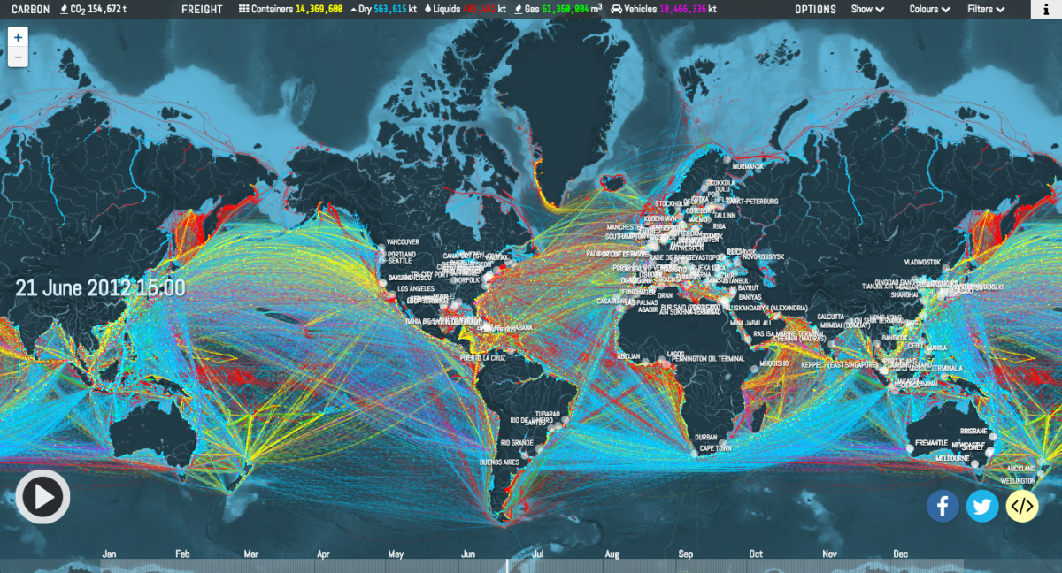
How important is transportation to modern lifestyles. At any point in time thousands of ships are transporting raw materials, intermediaries and finished goods across oceans and along coasts. Your breakfast can have fresh fruit from Chile, China, New Zealand, Brazil or South Africa. The price of a pint of fresh blueberries from Peru is at least to Canadians less than a quarter of the minimum hourly wage. The transport system, particularly that for time dependent food products is in many ways a miracle of modern organization – but also incredibly fragile in the face of any disruption to routes, ports, climate weather, or energy prices. The map below shows just how extensive the system is as the life’s blood of world commerce.
A New Map lets you visualize shipping traffic around the world. Interactive data visualization illustrates the incredible number of ships criss-crossing the world’s oceans at any given time.
See: https://www.canadiangeographic.ca/article/map-lets-you-visualize-shipping-traffic-around-world?utm_source=newsletter&utm_medium=email&utm_campaign=cgextranews for full article and other maps.

Leave a Reply